My 3:15 AM alarm rings, and my eyes begin to adjust to the light in the small studio cabin at the North Rim of Grand Canyon National Park. I begin to slowly pack my final belongings, brush my teeth, and start cold soaking some prepared oats to give me some energy for the long journey ahead. Today, I am backpacking into the Grand Canyon, descending about 6,500’ along 14 miles along the North Kaibab trail, which is part of the “Rim-to-Rim” hike that less than 1% of all visitors attempt at the park annually. After catching a ride, which is about 4 hours long, to the North Rim, I will be walking back to the South Rim over 25 miles. I’ve done this trek before in one (long) day, but this time, I get the opportunity to conduct field work at two spots in the inner canyon and take my time on this long and strenuous trail.
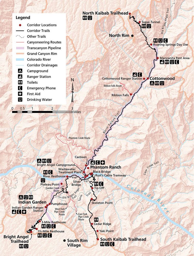
From Sunday to Tuesday, I will be hiking along the canyon corridor, which comprises the North Kaibab (14 miles), South Kaibab (7.5 miles), and Bright Angel (10 miles) trails (Fig. 1). I will stay at Phantom Ranch the first night after hiking down the North Kaibab in the employee bunkhouse, which offers a welcoming air-conditioned stay amidst the intense heat wave that the bottom of the canyon is currently experiencing. At Phantom Ranch, which is a historic tourist destination near the confluence of Bright Angel Creek and the Colorado River, I will be monitoring and updating the site protocols for trees that were initially established for the Local Touchstones: Phenology and Climate Change project that I am working on for my research project as an SIP Fellow this summer. Similarly, up the Bright Angel trail, there are ten more trees that will need to be monitored on our next day at Havasupai Gardens (formally known as Indian Gardens). For now though, I plan on putting one foot (and trekking pole) in front of the other and hiking along the North Kaibab, trying to beat the intense July heat that will soon be overwhelming the canyon – and my wellbeing.
Credit: Jack Lewis
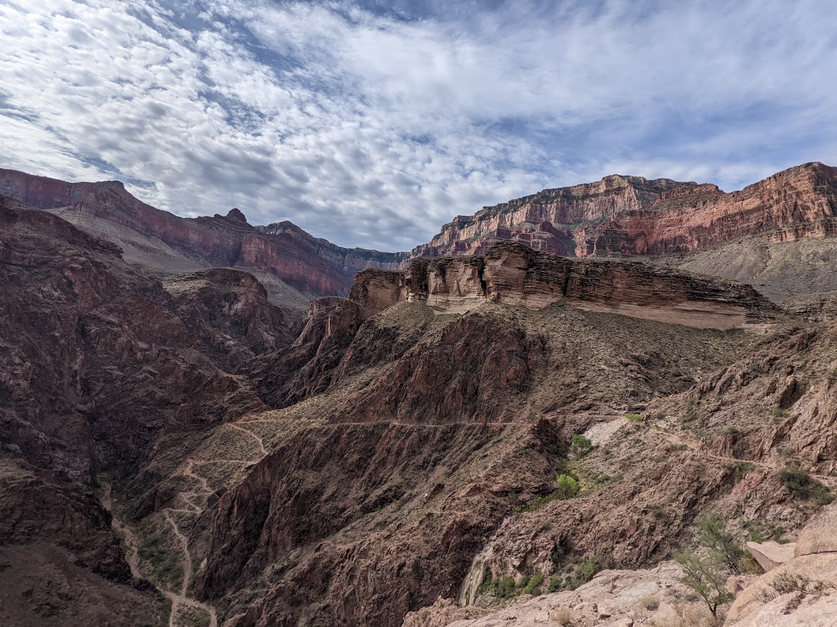
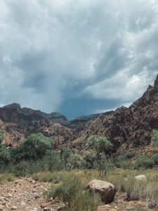
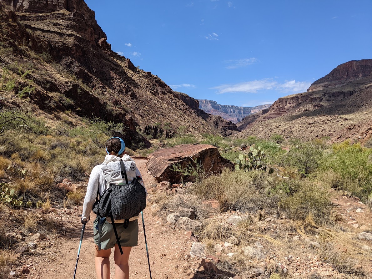
The North Kaibab is the least frequented of the three trails that make up the Rim-to-Rim hike, especially in the summer, because of “the box”, which is a section along the trail after the initial descent that is known for the brutal heat that is trapped inside the canyon walls and breaks hikers down to their last shred of energy (Fig. 2). At this point, it is climbing into the low 100°F mark, and I am trying to find the balance between getting to my destination (and air-conditioning) as quickly as possible while also trying to keep a sustainable and healthy pace. I have two volunteers with me, as it is extremely dangerous to attempt this hike without a partner or group, and we dunk our heads, hats, and shirts into the refreshing waters of the Bright Angel Creek every chance we get. Finally, around 12:00, we arrive at Phantom Ranch and immediately grab the most refreshing cup of ice-cold lemonade I’ve ever tasted.
My crew that I have assembled to help me with the monitoring in the canyon have all arrived, and we take some time after the knee-jarring journey across the steep North Kaibab to rest in the bunkhouse and wait until the afternoon heat subsides. We watch a storm threaten the canyon from the safety of a screened-in porch, and the quick rain provides nothing but an overwhelming humidity that makes our afternoon plans a bit less exciting (Fig. 3). Alas, we gather the strength to search for the trees that we are monitoring, and spend the next three hours walking aimlessly through Phantom Ranch searching for ten cottonwood trees (Populus fremontii) that we have nothing but a 9-year old photo to identify. We avoid the squirrels, deer, and terrifyingly large tarantula hawk wasps to find the trees to take updated photos, create site descriptions, and record GPS data points to eventually develop into monitoring maps as well as interpretive media. The process is long, and a bit frustrating, but we eventually finish as the sun begins to set over the canyon walls. We finish our day with a tasty helping of fajitas and ibuprofen to help our aching joints from the descent, and sleep in the comfort of our 67° bunk room in an almost comatose state.
Credit: Jay Gearries
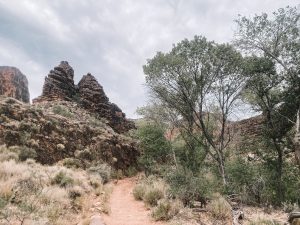
The next day’s hike is much less intimidating, with only a 5.5 mile hike from Phantom Ranch to Havasupai Gardens. These are easy miles with only 1,500’ of elevation gain, and we are delighted to find that the journey is filled with an overcast sky and pleasant temperatures in the low 80’s (Fig. 4). We reach Havasupai Gardens around 10:00 AM, just as the clouds are dissipating. Havasupai Gardens is one of my favorite places in the southwest, as it offers a lush and diverse oasis in an otherwise arid and unforgiving landscape. Mule deer frequent the area, as well as riparian vegetation species such as the water-loving Fremont cottonwood, coyote willow (Salix exigua), and honey mesquite (Prosopis glandulosa) that thrive from the groundwater recharge and Garden creek watershed that provided water to Havasupai farmers for generations before they were forcibly removed over a century ago. We take time to honor those peoples and those who came before us.
Credit: Jay Gearries
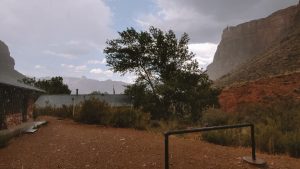
I am fortunate to stay in another air-conditioned employee bunkhouse, where we wait for the afternoon heat to subside by playing guitar, watching old western movies left by Grand Canyon trail crews from seasons passed, and sharing stories from other desert adventures. Around 4:00, we hear distant thunder as an afternoon storm cell rolls through. I am expecting the storm to dissipate as one had the evening before, since the canyon creates pressure systems that sometimes keep storms out of the inner canyon. However, we soon start to hear rain on the roof above us and we are ecstatic to watch a monsoon roll through the Havasupai Garden campground (Fig. 5). After the rain provides a pleasant cooldown of the area, we begin to conduct our tree monitoring as we had the night before, but we find these massive cottonwood specimens much easier to identify, and we finish in about an hour and a half. We spend our evening relaxing and cooking a hearty dinner, waiting for the stars to appear in the night sky, which bring tears to my eyes as I get to witness the most vibrant Milky Way I’ve ever laid eyes on behind the backdrop of canyon buttes, mesas, and cliffs.
Credit: Jack Lewis
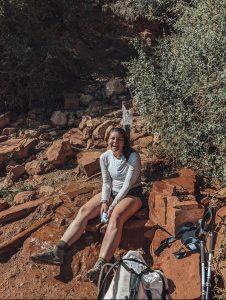
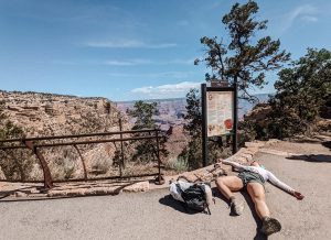
The morning arrives on day three and I am mentally preparing for the arduous hike out of the canyon. My joints are stiff and my muscles are pulsing with lactic acid from the previous days’ journeys. In addition to the actual trail miles we hiked to get from site to site, we also record around 3-4 miles per evening during our tree monitoring. I have done the entirety of the Rim-to-Rim hike before, but I had not physically trained for this one and I am now paying the price. I drink my morning coffee and begin the 4.5 mile/3,200’ climb up the remainder of the Bright Angel Trail to finish out my trek. I take every opportunity possible to soak in creeks and water spigots at the rest houses and consume water and electrolytes like there’s no tomorrow (Fig. 6). Surprisingly, I find my “trail legs” and start hiking up the moderately steep trail at a pace that puts me at the South Rim in no time at all. I am exhausted (Fig. 7), but I feel a sense of accomplishment and fulfillment that is unparalleled to any field work that I’ve ever been involved in. My final mileage for the trip, including fieldwork mileage, was 33.5 miles and over 11,000’ of elevation change, and I will be feeling this for days. (Update – I am definitely still feeling it!)
Credit: Jack Lewis
The opportunity to hike the Rim-to-Rim trail as part of my SIP internship this summer is unlike any other experience I can imagine. I personally think there are few ways to better experience the Grand Canyon than to hike through it. However, I must admit that this trail is not for the faint of heart nor the physically unfit, as it has provided me with intense soreness and exhaustion even as a seasoned hiker (see more information about the Rim-to-Rim hike here). I am very excited to create maps using the data points that we collected at our inner canyon sites to hopefully involve volunteers and citizen scientists in our monitoring protocols. This part is a work in progress and will be completed by the end of my internship, and will be one small addition to the large set of deliverables that I am producing for my summer project. I have to say though, the Rim-to-Rim trail is definitely a highlight of the summer that will stay for me for years to come (Fig. 8).
Credit: Jack Lewis
Thank you to Gabe Watts (GRCA Nursery) and Jack Lewis (volunteer) for accompanying me on this journey. Thank you to Annie Kilby and Lonnie Pilkington for making this trip possible for us and providing us with the necessary logistical support to make this happen.