The Ecology of Bourbon Country
By Bruce A. Byers
Just north of what is now Frankfort, Kentucky, the capital of the state, the Kentucky River, flowing north at that point, makes a right-angle bend to the west. Sandbars developed at that turn, creating a shallow ford where bison crossed the river on annual migrations from east to west and back. Daniel Boone passed here, following what was called the “buffalo trace,” in 1771. Euro-American settlers followed Boone and the bison migration route, expanding westward into the territory of indigenous Shawnee peoples in the early decades after the Revolutionary War. In 1812, the trail was considered of such political importance that mounted troops called “rangers” began patrolling the trace to protect travelers from attacks by wild animals and Shawnee warriors.
Seventy-five miles farther west, the bison again had to cross the much larger Ohio River. A shelf of Devonian limestone created a sharp drop, and a falls in the river, at present-day Louisville. The buffalo road crossed the river there, at the wide shallows above the falls, and continued on west into what is now the state of Indiana.
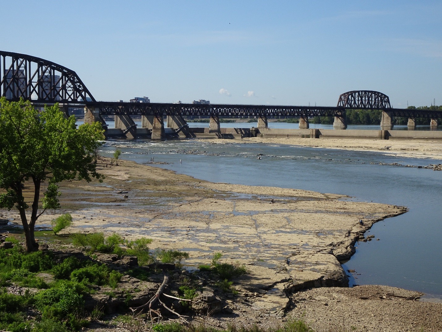
Falls of the Ohio River at Louisville, Kentucky. Photo by B. Byers.
The Ecological Society of America (ESA) held its 2019 annual meeting in Louisville in the middle of August. In the Kentucky International Convention Center, the venue for the meeting, a sign above a drinking fountain said “And you thought bourbon was our most prized liquid.” It was a tease from Louisville Water, the local water company. Hashtags “#taste the difference” and “#drink local” promoted the ideas behind their slogan. The Kentucky bourbon industry claims its “limestone water” as a key ingredient in bourbon whiskey. As an ecologist I’ve encountered many situations where “ecohydrology” – the relationship between ecosystems and water – is a key to understanding the human-nature relationship in a place. So, since the First Principle of Ecology is “Everything is connected to everything else,” how could I not take advantage of this place to pursue my scientific curiosity about the buffalo trace, limestone geology, and anything and everything else ecologically linked to bourbon?

Louisville Water advertisement and drinking fountains in the Kentucky International Convention Center. Photo by B. Byers.
Because it was close to the meeting site, my first “field trip” on my scientific quest to understand the ecology of bourbon country was to the Falls of the Ohio State Park, a short drive northwest of downtown Louisville. I walked across the limestone flats that were now exposed along the river, and then toured the well-presented displays in the visitor center. About 390 million years ago, in the Devonian Period, the limestone over which the Ohio River flows here was the floor of a shallow, tropical sea about ten degrees south of the equator, off the southwest coast of the giant supercontinent of Pangaea. The warm waters supported a biologically diverse ecosystem; corals, bryozoans, trilobites, and brachiopods thrived. Meadows of crinoids – long-stemmed, flower-like echinoderms called “sea lilies” – and their now-extinct relatives called blastoids, were common. The calcium carbonate-containing skeletons of these creatures collected and compressed on the seafloor for tens of millions of years, eventually becoming a layer of limestone more than 1,000 feet thick. I was walking on top of it here, marveling at the mysterious patterns of ancient creatures emerging from the rock.
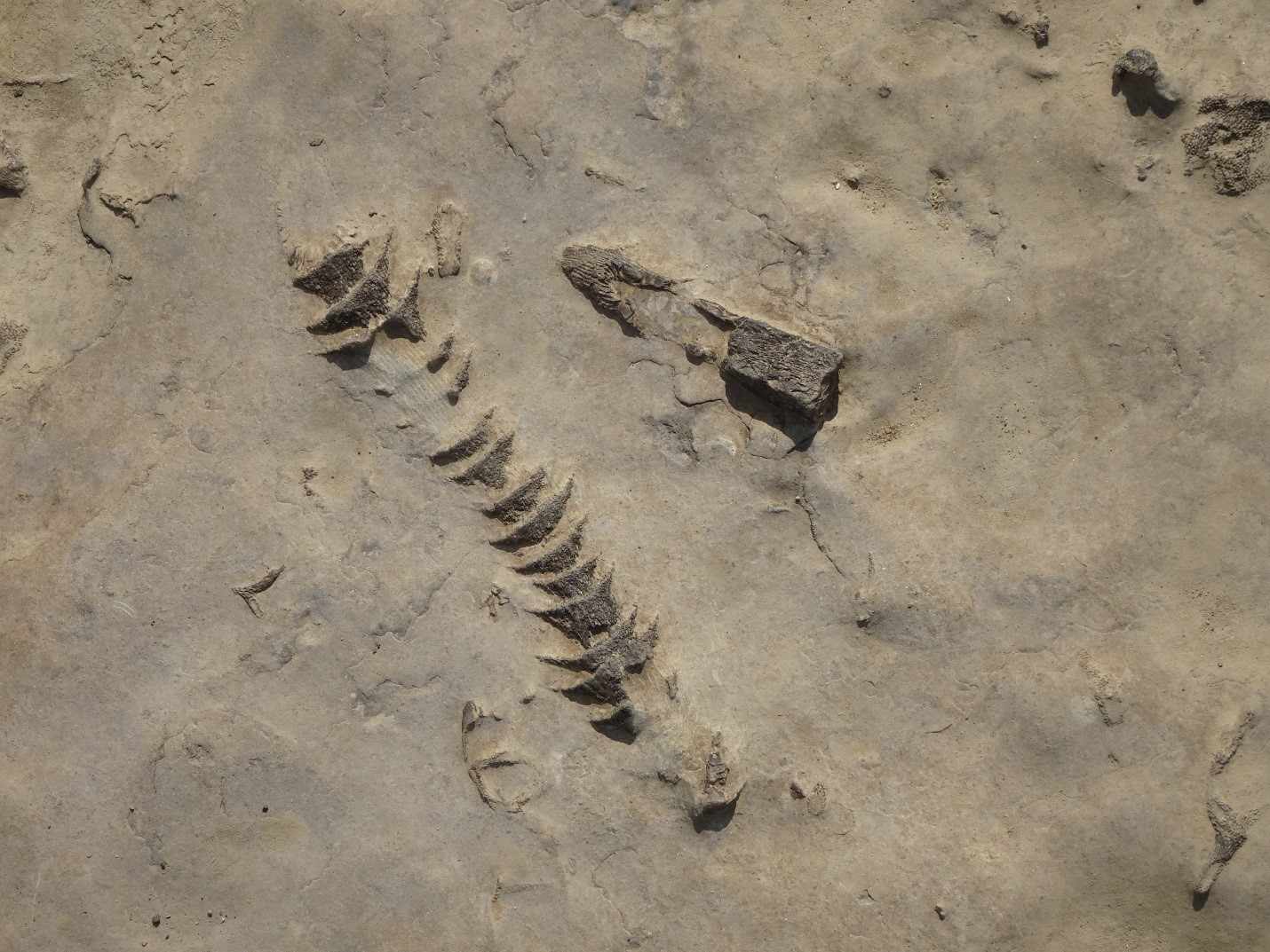
Fossils underfoot in limestone at the Falls of the Ohio State Park. Photo by B. Byers.

Mississippian Crinoid Meadow, painting by Sarah Hamblin. Image courtesy of Humboldt State University Natural History Museum.
——-
For my second field trip to understand the ecology of bourbon, I drove an hour east from Louisville on Interstate 64 to the Buffalo Trace Distillery. Two brothers, Hancock and Willis Lee, established a distillery here in 1775 – just as the Concord farmers were firing their “shot heard round the world.” They referred to its location as that shallow crossing used by migrating bison along the Kentucky River, marked on an old hand-drawn map as the “buffalo trace,” and from that note on that map, the distillery took its name. Buffalo Trace Distillery claims to be the oldest continuously-operating bourbon distillery in the United States. It was allowed to produce its “medicinal spirits” in limited quantities even during Prohibition.
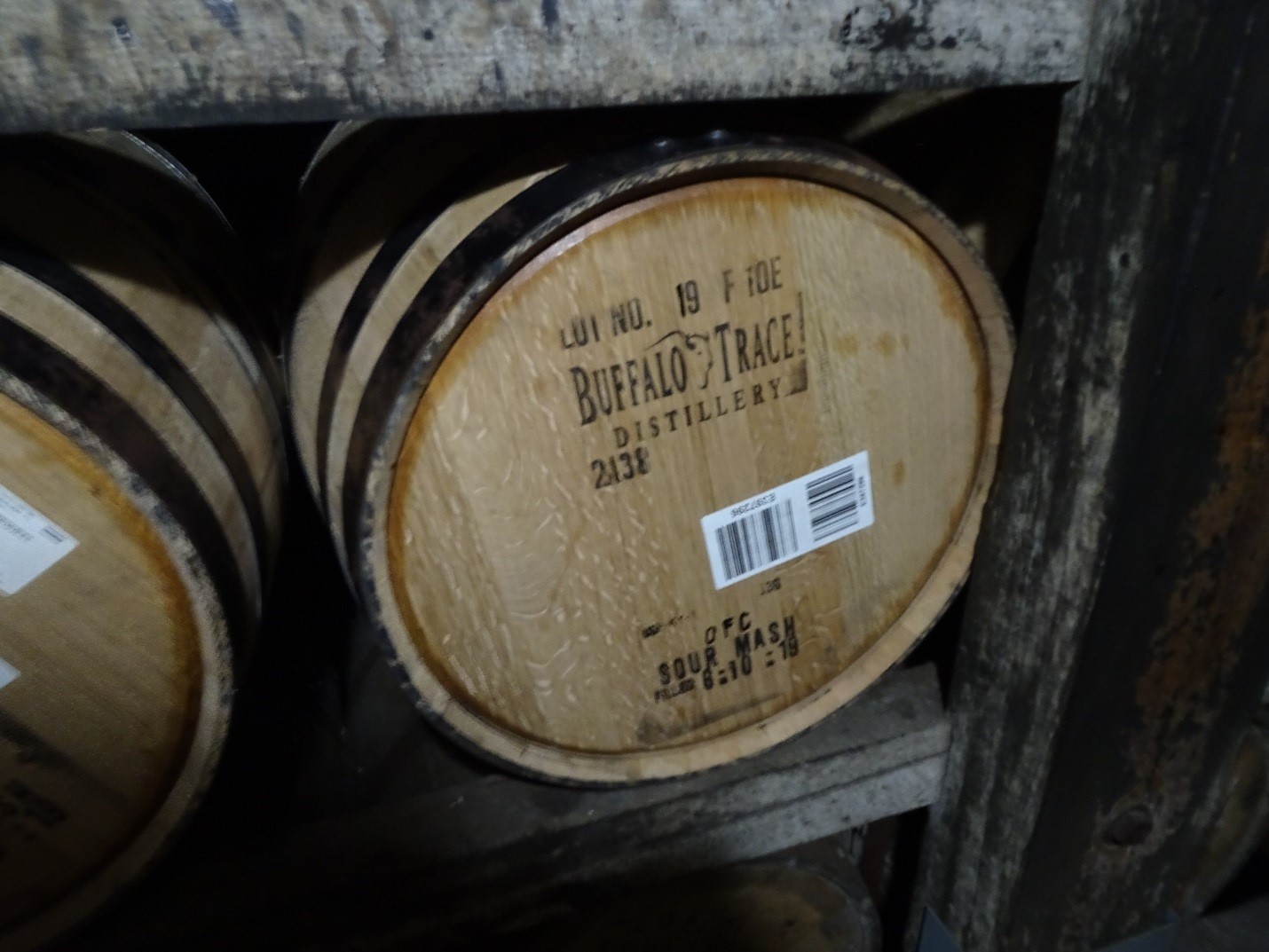
Aging bourbon in barrels at the Buffalo Trace Distillery. Photo by B. Byers.
On my Buffalo Trace field trip, I imbibed as much of the history of Kentucky straight bourbon whiskey as time and propriety – and the drive back to Louisville – would safely allow. Scots and Irish settlers moving from Appalachia down the Ohio River carried their home-country whiskey-making traditions with them, but adapted them to their new environment. Malted barley, the foundation for old-country whiskey, still played a role, but the starch that ruled the mash became corn – maize (Zea mays), that is, the native staple crop. In these Kentucky ferments, corn became the majority vote. While they were at it, the early Kentucky distillers tossed in some easy-to-grow rye, which added a decisive spiciness to the eventual elixir. The proportional recipe of grains – even today kept secret from distillery to distillery – were cooked up in limestone water from wells that tapped those fossilized Devonian crinoid meadows I’d walked over at the Falls of the Ohio. A yeasty starter from an earlier batch was pitched into the mash. The resulting fermentation was distilled into a high-proof moonshine, then aged, for years, in barrels made from local white oak that were first sterilized by burning the inside until the wood developed a scale-like surface called “alligator char.” In that charring process, oakwood is converted into sugarlike compounds that sweeten and complexify the eventual product.

Inside of a white oak barrel with “alligator char.” Photo courtesy of Cask.
——-
For my third field trip, I joined an official ESA-organized trip to the Hoosier National Forest, which reaches north into Indiana from a point about an hour’s drive west of Louisville along the old “buffalo trace.” The trip was organized by two plant ecologists who have been developing a national system – the U.S. National Vegetation Classification – to classify vegetation across the United States. We were guided in the field by three U.S. Forest Service staff, to learn about how they are trying to maintain the diversity of plant communities in the national forest through their management practices. Our first stop was the Boone Creek Barrens, where prescribed fire is being used to try to restore a plant community that was once much more common.
The big commercial tour bus that carried our group of ecologists from the convention center parked along a dusty gravel road at the Boone Creek Barrens site. We climbed off the bus, tucked pantlegs into socks and sprayed on repellent and insecticide for ticks and chiggers, and waded off-trail into the lush prairie vegetation being restored here. This area was deliberately burned only a few months earlier, in April of 2019, but the prairie plants were thriving. Big bluestem, Andropogon gerardii, a common tallgrass prairie species, was chest-high. Rattlesnake master (Eryngium yuccifolium), another plant of sunny prairie communities, was common. Blazing star (Liatris sp.) was blooming, and big yellow swallowtail butterflies were nectaring on yellow sunflowers. Old oaks, a few with fire scars, stood over the restoring “barrens.” Some small oaks had been killed back by the prescribed burn.
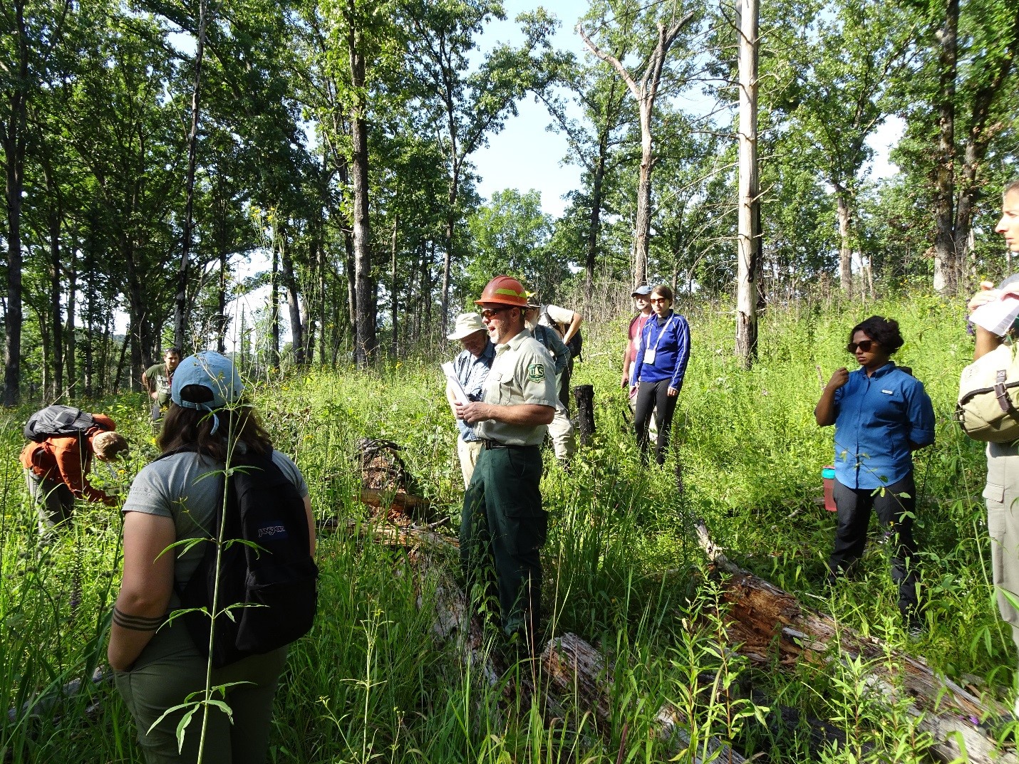
Ecological Society of America fieldtrip group at the Boone Creek Barrens restoration site in the Hoosier National Forest, 11 August 2019. Photo by B. Byers.
We first had to understand the ecological history of the place. Why is this called the “Boone Creek Barrens,” anyway? Daniel Boone and the Euro-American settlers, following the Buffalo Trace across the falls of the Ohio River into this region of Indiana, found many areas of open grassland with widely scattered trees. They called them “barrens” to contrast them with the closed-canopy deciduous forests of much of the surrounding country. In fact, as ecologists have since learned, these “barrens” were anything but barren in a biological sense. They were teeming with plant biodiversity – the eastern outposts of the sun-loving grasses and forbs of tallgrass prairie ecosystems from farther west or their close relatives.
But what were these prairie species doing here, farther east? One part of the story relates to the geology of the area. The aforementioned limestone formations, and sandstone layers deposited above them later, were uplifted, creating karst uplands and dry ridges. Species adapted to drier conditions would have had an advantage on those ridges, and lightning would have been more likely to strike and start wildfires there. Fires kill young trees and shade loving species, favoring fire-tolerant species and opening the canopy to the sun for prairie plants.
The other part of the explanation is human influence on ecosystems. The geological tendencies toward dry soils and the species that liked them were aided and abetted by Native peoples, who burned these landscapes because their indigenous science showed them that the ungulate grazers and browsers they hunted – bison, deer, and elk – flocked to those burned areas, which flushed with new grass and edible plants after a fire. The Buffalo Trace followed a patchwork of grasslands maintained by fires set by indigenous peoples. Before Euro-American settlers arrived, a symbiotic ecological relationship between humans and natural ecosystems spanned the boundaries of our current states along the old Buffalo Trace, across Kentucky and Indiana and on farther west.
Richard Guyette and two colleagues presented their study of the fire history of the Boone Creek Barrens in a 2002 paper in the American Midland Naturalist titled “Fire and Human History of a Barren-Forest Mosaic in Southern Indiana.” They looked at the tree rings of 27 post oak (Quercus stellata) trees at Boone Creek; the tree rings recorded dates from 1654 to 1999, and included 84 fire scars. The analysis showed that the average fire interval here was 8.4 years, and that about one-fifth of the trees had been scarred – in other words, fire was quite frequent and common. They found no significant correlation between droughts and fires, but rather with the migrations of Native peoples and Euro-American settlement. Their “bottom line” conclusion from the study was: “Temporal variability in the fire record illustrates not only the dynamic nature of anthropogenic fire regimes but also the importance of humans in culturing pre-settlement barrens communities.”

Big bluestem (Andropogon gerardii) at the Boone Creek Barrens. Photo by B. Byers.
The Hoosier National Forest management plan 2006 described 24 special conservation areas where active management is designed to maintain certain ecological aspects of the forest. The Boone Creek Barrens is one of those sites, and prescribed burns are part of the plan to maintain the area. The plan also designates other areas, quite small, for timber harvest. One of the main species of interest? White oak. For bourbon barrels, of course.
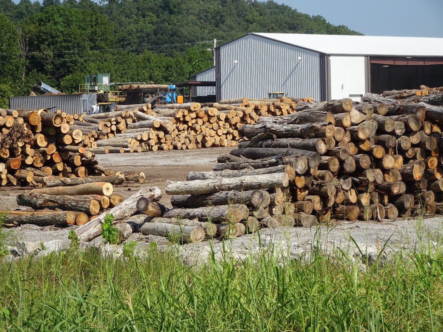
White oak logs in a local lumberyard in northern Kentucky, destined for bourbon barrels. Photo by B. Byers.
Our next stop was Buzzard Roost, a picnic area with a short nature trail on the bluffs overlooking the Ohio River. Turkey vultures and black vultures – “buzzards” in local parlance – hang out here, thus the name of the place. Before eating our packed lunches, we walked the short trail along the bluffs. The Forest Service recently cut some trees below the trail to maintain the view of the river below. This was another perfect place for our U.S. Forest Service guides to give us a lesson in the challenges of forest management in the Hoosier National Forest.
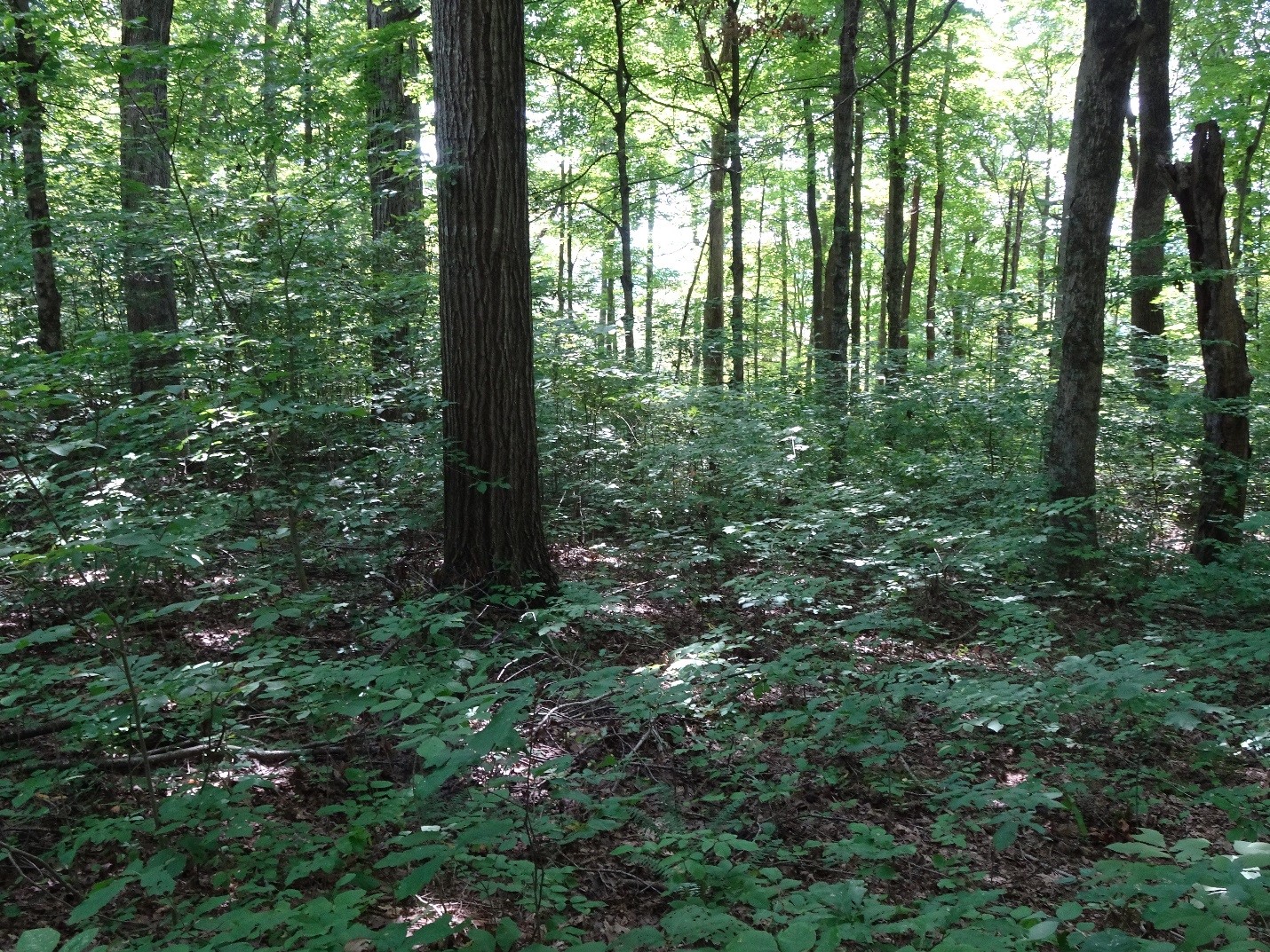
The ecological changes happening here in southern Indiana are a case study of a widespread ecological trend in the eastern U.S. described by the term “mesophication.” What that technical term means is that plant communities are increasingly dominated by species that like wetter, shadier conditions. A 2008 paper titled “The Demise of Fire and ‘Mesophication’ of Forest in the Eastern United States,” by Gregory Nowacki and Marc Abrams, discussed the relationship between changes in human-caused fire frequency and the ecological shift toward species that like shade and moisture. Along the trail at Buzzard Roost, we saw an eager young generation of sugar maple (Acer saccharum) and tuliptree (Liriodendron tulipifera) – which do well in shady, moist conditions – springing up in the understory of an older forest of widely spaced oaks and hickories – which thrive in drier conditions where fire is common.
As we walked the Buzzard Roost trail, I talked with Travis Swaim, the Forest Service ecologist whose job is to advise the Hoosier National Forest in its management strategies. “We can’t fight mesophication everywhere in the forest,” he said. “We have to pick and choose our battles. On dry sites like the Boone Creek Barrens, we have the money to conduct prescribed burns to favor oaks and prairie species. At wetter sites, like here at Buzzard Roost, we don’t have the resources to fight the ecological trajectory of mesophication.” He seemed resigned to allowing the next-generation forest of tuliptrees and sugar maples to take over here. He referred me to another ecological research paper by Daniel Dey, “Sustaining Oak Forests in Eastern North America,” from the journal Forest Science in 2014, which places the challenge of retaining oak-dominated forest communities in a wider context. It’s conundrum not only in southern Indiana, but throughout the eastern U.S. and beyond.
Understory of shade-tolerant sugar maple and tuliptree at Buzzard Roost. Photo by B. Byers.
After lunch at Buzzard Roost, our final stop was Hemlock Cliffs. Hemlock Cliffs is a deep glen cut into the karst country. A harder sandstone layer caps the softer limestone here, creating what in these parts is called a “rock shelter,” a shallow, open cave with a protective overhang. A small waterfall plunges over the same capping layer and drops into the gorge nearby. The deep shade, humidity, and cool temperatures have created a refuge for eastern hemlock, Tsuga canadensis, whose native range is north and east of this outpost in southern Indiana. What are eastern hemlocks doing here? I felt us circling on the back of a buzzard around the deep-time cycle of the place.
On a hot August afternoon even relatively cool Hemlock Cliffs feels far from glacier country, but it wasn’t always. The ice sheet that covered half of North America from 1.8 to 1.2 million years ago, called the “pre-Illinoian,” reached its southern limit not far away. It rerouted the ancient Teays River, establishing the course of the Ohio River along its southern margin. The much more recent Wisconsin ice sheet, which again covered much of the continent from 23,000 to 11,000 years ago, stopped less than 50 miles north. Hemlocks would have expanded and contracted their range across the changing landscape, and as the ice age climate retreated to the north, they found a refuge – a pocket of acceptable climate to hang out in, in Hoosier country here at Hemlock Cliffs.
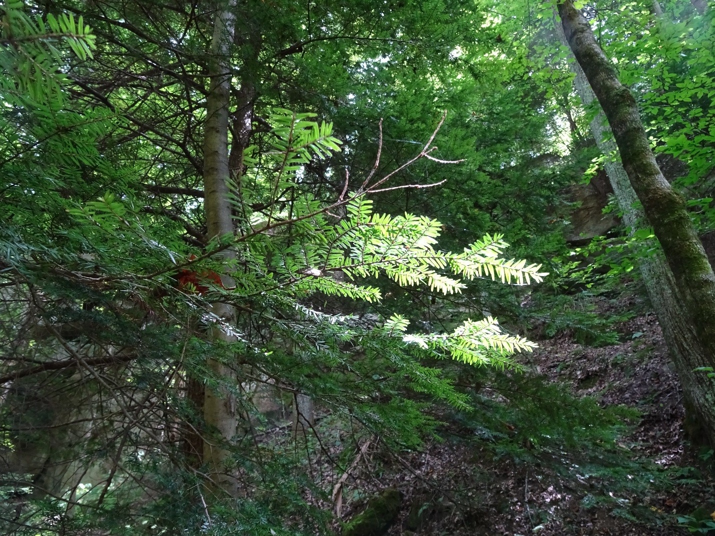
Eastern hemlock (Tsuga canadensis) at Hemlock Cliffs. Photo by B. Byers.
Eastern hemlocks have now been almost completely killed off over approximately half of their natural range by an aphid-like insect called the hemlock woolly adelgid (Adelges tsugae), accidentally introduced from Japan. This is another unfortunate case study of what could be called ecological globalization, the ecological impact of introduced alien species, diseases, and pests. The demise of the American chestnut, once a keystone species of eastern forests, is another sad example. So far, the tiny population of eastern hemlocks at Hemlock Cliffs is protected, because of its isolation, from this deadly introduced pest. It’s a refuge from this new threat, and not only from a changing climate.
While walking the trails at Hemlock Cliffs, I again fell into a conversation with Travis Swaim, the Forest Service ecologist. He described being off-trail in the woods not too far from here, noticing the understory leaves suddenly moving, and feeling a wind of cool air blowing from an opening in the ground. It was a once known but long forgotten entrance into the karst underworld. The cave entrance was circled by an old stone wall, and he found two headstones of old graves nearby. He is coming back with a spelunking colleague who is also a bat expert to explore it soon, he told me. Endangered Indiana bats (Myotis sodalis) seem to be using small, obscure, unvisited caves, like the one Travis stumbled upon, as refuges from white-nose syndrome, a fungal disease that has devastated North American bat populations of many species.

Dixon Cave, Mammoth Cave National Park (closed to entry). Photo by B. Byers.
We were again circling back, in that conversation, to the deep-time limestone bedrock of the place, and to the concept of “refugia.” Ecological refugia are places where species can hide out from the changes going on at a faster pace elsewhere, on the “surface” – the “surface” of space and time. Finding pockets of refuge from ecological change has always been part of the repertoire of adapting, evolving species. It’s part of the dynamic of life on a dynamic planet. But, as humans have accelerated ecological change exponentially, taking refuge takes on a new meaning and a new urgency. Resilience – a concept that in ecology means the ability to weather disturbances and disruptions and return to a steady state – may sometimes mean retreating to refugia, waiting it out until the coast is clear, and venturing out again, as and if possible.
Everything is connected to everything else. An ecological story connects bourbon country across 400 million years. Plate tectonics, drifting continents, and crinoid meadows abloom under Devonian seas. Ice ages coming and going, and plant communities following and flowing over the changing landscape. the effect of anthropogenic fire on vegetation. Bison and human migrations along the Buffalo Trace. Scots-Irish settlers with a distilling tradition. Ecological research on forest mesophication and its application in current forest management plans. “Alligator char” that transmogrifies oakwood into flavors of the fire-loving barrens and their sunloving plants, rattlesnake master and blazingstar.
Take a sip… and another, slow, sip. Savor it. Kentucky Straight Ecological Deep Time Bourbon Whisky. Bourbon distills the taste of everything from ancient reefs and dry prairies grazed by bison to hemlocks and hidden caves.

Prairie plants at the Boone Creek Barrens restoration site in the Hoosier National Forest: rattlesnake master (Eryngium yuccifolium) and blazing star (Liatris spp.). Photo by B. Byers.
Sources and links:
- Buffalo Trace brochure, USDA Forest Service, Hoosier National Forest, April 2011.
- Falls of the Ohio State Park
- Mississippian Crinoid Meadow, painting by Sarah Hamblin. Natural History Museum, Humboldt State University.
- Buffalo Trace Distillery, History
- Cask with “alligator char” photo
- United States National Vegetation Classification
- Guyette, Richard P., Daniel C. Dey and Michael C. Stambaugh. Fire and Human History of a Barren-Forest Mosaic in Southern Indiana. The American Midland Naturalist, Vol. 149, No. 1 (Jan., 2003), pp. 21-34.
- Nowacki, Gregory J. and Marc D. Abrams. 2008. The Demise of Fire and “Mesophication” of Forest in the Eastern United States. BioScience: Vol. 58, No. 2. pp 123-138.
- Dey, Daniel C. 2014. Sustaining Oak Forests in Eastern North America: Regeneration and Recruitment, the Pillars of Sustainability. For. Sci. 60(5):926–942.
- Hoosier National Forest Management Plan, 2006.
- Hemlock Woolly Adelgid. USDA National Invasive Species Information Center
- Indiana Bat (Myotis sodalis), U.S. Fish and Wildlife Service, Midwest Region Endangered Species.
Readers wishing to get in contact with the author may contact Bruce Byers at bruce.byers@nullverizon.net